Destroyed homes, horrific scenes and at least seven deaths are the results of Hurricane Beryl’s catastrophic path through several Caribbean islands. The hurricane reached Category 5, the maximum level on the Saffir-Simpson scale, with winds of 260 km/h and gusts approaching 300 km/h.
In the Caribbean nation of Saint Vincent and the Grenadines, the prime minister described the situation as “total devastation” caused by Hurricane Beryl. The scenario is similar in Grenada’s eastern neighbor.
Photos and videos shared on social media showed horrific scenes in San Virginia and Granada: homes destroyed; police stations, schools and hospitals damaged; streets littered with the remains of destroyed roofs and huge waves sweeping across roads and property.
At least four people in the Caribbean and three in Venezuela were killed in the hurricane that hit Jamaica on Wednesday. Several online messages asked for information about family members on the islands of Canouan, Union and Mayro in St. Virginia, which along with Grenada, Carriacou and Petit Martinique are among the hardest hit.
On Monday night, Grenada’s Prime Minister Deacon Mitchell told a news conference that Carriacou had been leveled within half an hour. On Tuesday night, after visiting Carriacou, he described “Armageddon-like” scenes of “almost total devastation,” with nearly 98 percent of the buildings damaged or destroyed, and the power grid and communications systems almost completely destroyed.
“Having seen it in person, there’s really nothing that can prepare you for seeing this level of devastation. It’s almost like Armageddon. Damage or near total destruction of all buildings, whether public buildings, residences or private facilities. Complete destruction and devastation of agriculture, complete and total destruction of the natural environment. There’s no vegetation anywhere on Carriacou Island,” he said.
In a video posted online, journalist Vincent Damion McTeer described the “unimaginable” destruction, comparing it to the aftermath of a bombing. “Imagine stoves flying through the air, houses being blown away, lifted, destroyed, and simply taken away with the wind. It’s that simple… imagine,” one woman said.
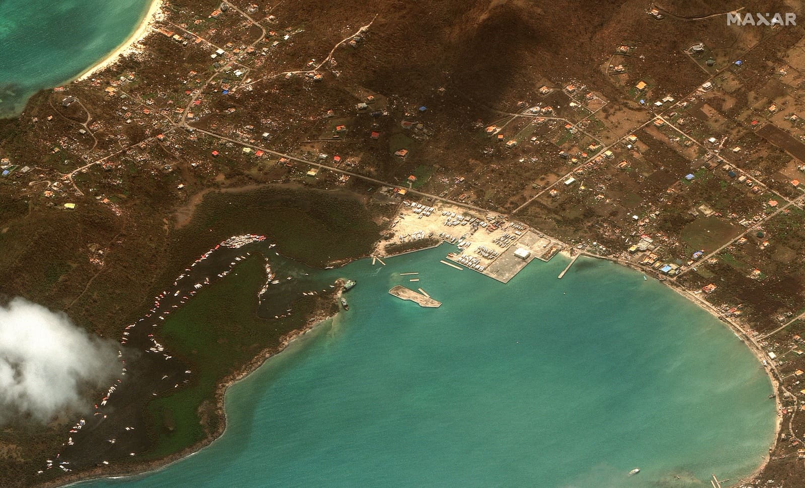
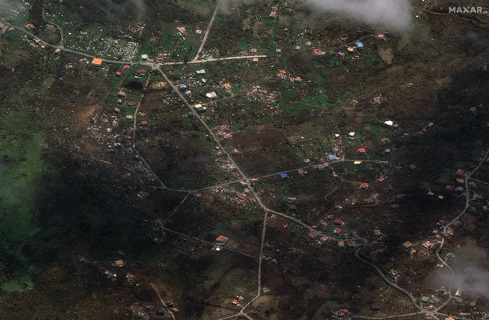
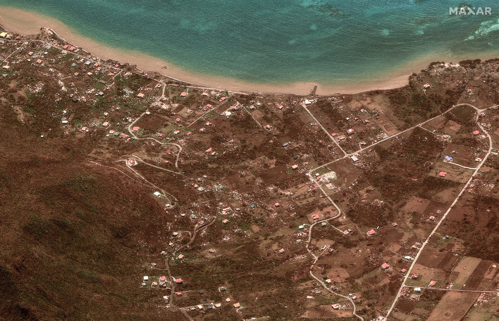
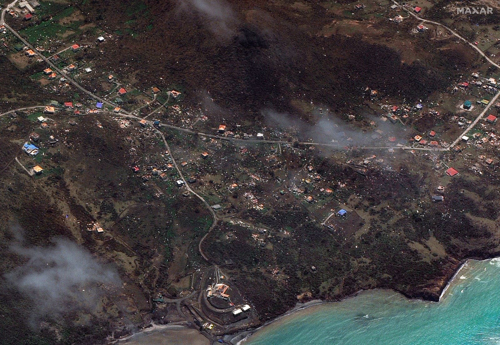
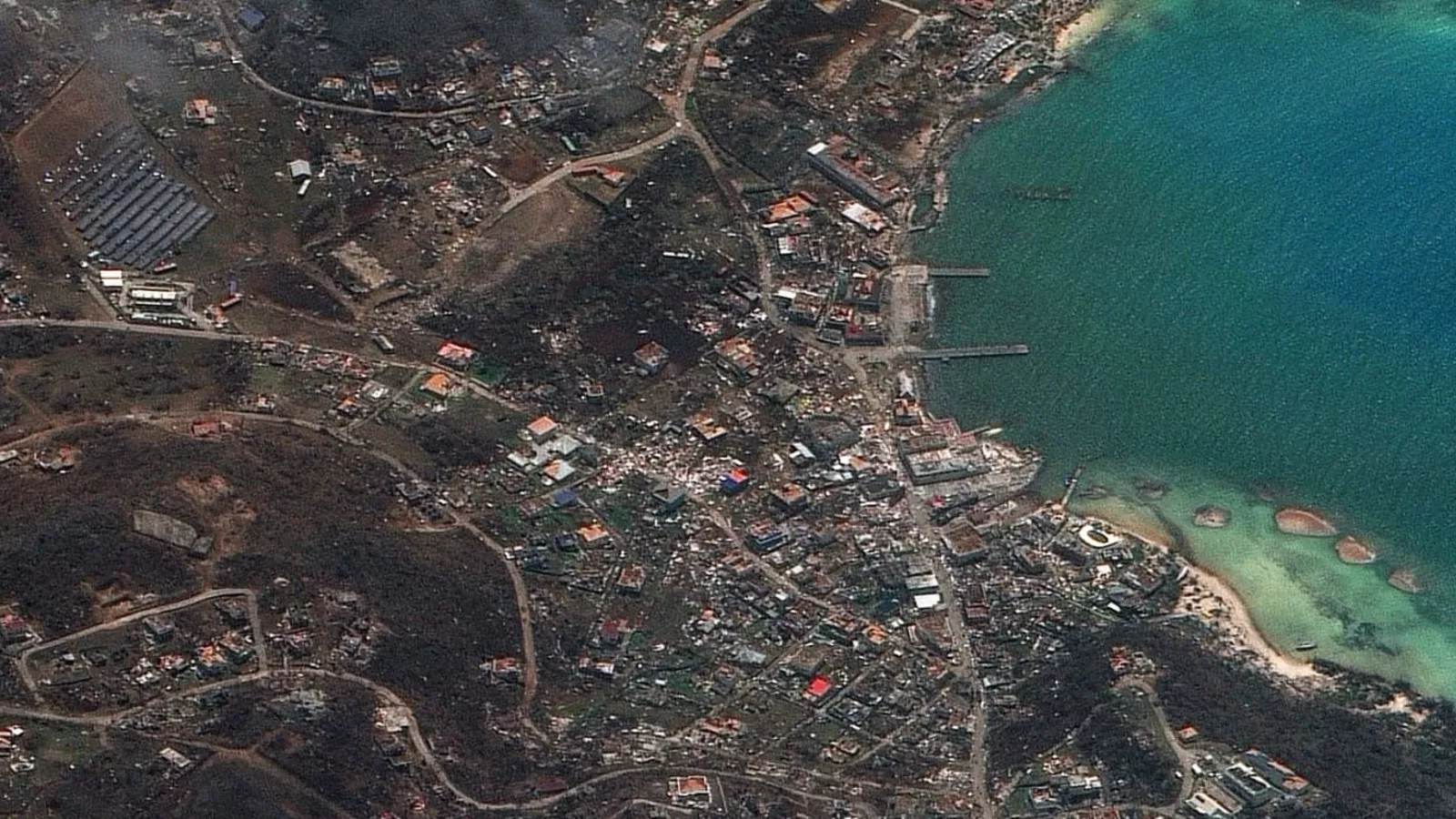
High-resolution satellite images from space taken by Maxar Technologies show the scale of the catastrophe that Hurricane Beryl has brought to several small island nations in the Caribbean since the weekend with absolute devastation.
Satellite image shows Clifton Harbour on Union Island, Saint Vincent and the Grenadines, on July 2, 2024, after Hurricane Beryl passed | Maxar Technologies / AFP / Metsol Meteorology
Satellite image of Argyle on Carriacou Island, Grenada on July 2, 2024, with extensive damage caused by Hurricane Beryl | Maxar Technologies / AFP / Metsol Meteorology
Satellite image of Brunswick, on Carriacou Island, Grenada, on July 2, shows damage from Category 5 Tropical Cyclone Beryl | Maxar Technologies / AFP / Metsol Meteorology
Satellite image shows a general view of northeastern Carriacou Island, Grenada, on July 2, after Hurricane Beryl passed through | Maxar Technologies / AFP / Metsol Meteorology
Satellite image of Carriacou Island, Grenada, July 2, devastated by winds of over 250 km/h during the devastating passage of Hurricane Beryl | Maxar Technologies / AFP / Metsol Meteorology
The storm is historic because it has set several records. Beryl formed on Friday in the southeastern Antilles and quickly became a Category 1 hurricane on Saturday. It formed “much farther east in the Atlantic than is typical for this time of year.”
Beryl became the first Category 4 hurricane to occur in June, the first month of a hurricane season that runs through November. Furthermore, it became the first Category 5 hurricane ever recorded in the Atlantic, in early July, two weeks before the previous record-breaking hurricane, Emily in 2005.
MetSul Meteorologia is on WhatsApp channels. Subscribe here To access the channel in the messaging application and receive forecasts, alerts and information on the most important weather and climate events in Brazil and around the world, with exclusive data and information from our team of meteorologists.

“Music fanatic. Professional problem solver. Reader. Award-winning tv ninja.”




More Stories
Couple retakes glacier photo after 15 years, surprised by changes: ‘It made me cry’
Two killed in hotel collapse in Germany – DW – 07/08/2024
Lula speaks for half an hour on phone with Biden about Venezuela’s electoral impasse | Politics