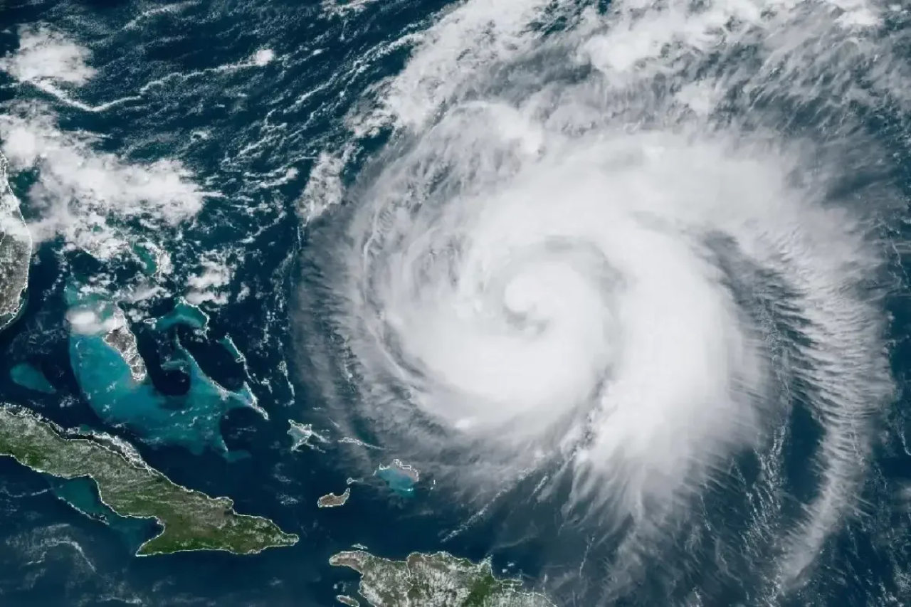
Tropical Storm Francine It is poised to become a hurricane threatening the Louisiana coast. Learn more about this event and Atlantic Hurricane Season.
Francine has been strengthening over the warm waters of the Gulf of Mexico and is on its way to the southern United States. After three weeks without intense tropical systems in the North Atlantic basin, due to unfavorable weather conditions, the system named Francine has emerged as the sixth named storm of the 2024 season.
What is the forecast for Hurricane Francine?
Francine formed on Monday, September 9, off the eastern coast of Mexico, and had previously brought moderate rain and winds. However, instead of hitting Mexico directly, it moved northeastward. It is now expected to make landfall in Louisiana on Wednesday, September 11, with greater intensity.
What do you expect from Francine’s arrival?
In the latest measurements, the phenomenon had wind speeds of 105 km/h and a central pressure of 988 hectopascals. The waters of the Gulf of Mexico, where temperatures range between 29 and 31 degrees Celsius, provided the energy needed to transform Francine into a Category 1 hurricane, with winds that could exceed 119 km/h.
Weather models indicate that Francine could become a hurricane Tuesday night. As it continues to strengthen through the morning, it could make landfall on the Louisiana coast with winds of up to 90 mph (140 km/h).
Are category 1 hurricanes dangerous?
Although Category 1 hurricanes are considered the least intense on the scale, Ambassador Simpsonthey can still cause significant damage. The scale, which ranges from Category 1 to 5, ranks tropical cyclones based on the intensity of their winds. Hurricanes in this category can knock down power lines, tear off roofs and cause flooding.
Examples of Category 1 hurricanes with significant impacts include:
- Beryl (2024)Millions left without power in Texas.
- Nicholas (2021):Brought more than 450 mm of rain to Mississippi.
- Isaac (2012):caused flooding in Louisiana.
Monitoring and basic preparations
Since Francine’s arrival coincides with the peak of the hurricane season, between June 1 and November 30, authorities and citizens are on high alert. Forecasts indicate heavy rainfall (from 150 mm to 305 mm in some areas), as well as the possibility of storms and tornadoes.
Understanding the devastating impact that even minor hurricanes can have, continued monitoring and precautionary measures are critical. The lessons learned from Hurricanes Beryl, Nicholas, and Isaac are a stark reminder that such events should not be taken lightly, regardless of their initial classification.
Therefore, Hurricane Francine is being closely monitored, and preventive measures are being taken to reduce risks and protect residents of affected areas.
Follow us on Google News

“Music fanatic. Professional problem solver. Reader. Award-winning tv ninja.”


More Stories
Remember? Unpublished photo reveals Titan submarine at sea floor
World’s largest amber lump discovered! Almost 4kg of stone as heavy as a door!
Kamala Harris vs. Donald Trump: New Poll Shows Debate’s Impact on Presidential Race