Along the coast of the United States, there is a giant geological fault known as the Cascadia subduction zone; Mega earthquakes and tsunamis are likely to occur
12 June
2024
– 03:45
(Updated at 04:51)
Found beneath much of the United States and Canada, the Cascadia subduction zone is a giant coastal fault line that is prone to subduction. Mega Earthquakes (or Megaseisms) and tsunamis above 30 m with high destructive power. Despite the dangers, seismologists are still looking for tools to predict potential disasters.
Specifically, the Cascadia subregion runs from northern California to Canada through Oregon and Washington. A geological fault, with enormous destructive power, borders the Pacific Ocean.
There, the Juan de Fuca oceanic plate collides Tectonic plate In North America, the denser one (the ocean) dives under the lighter one (the continent), sub zone.
Next, understand what a sub-zone is:
Cascadia Subregion
In 1700, the Cascadia region was finally hit hard by the movement of tectonic plates, which caused severe earthquakes in the region. However, as suggested by geologists who specialize in analyzing geological faults, these episodes repeat themselves every 500 years. So there is little time to prepare.
In theory, new motions in the subduction zone could trigger earthquakes of magnitude greater than 9 degrees. Richter scale. Even tsunamis can be severe One was recorded in Japan in 2011, causing the Fukushima tragedy.
Mega Earthquake and Tsunami Risk in the US
A new study published in the journal Science Advances seeks to better quantify the structures and subsurface dynamics of the Cascadia subduction zone, with the aim of defining possible scenarios and implications – To date, no technology can predict an earthquake.
“Samples [e mapas da região] Those used by public agencies are based on limited amounts of old, low-quality data from the 1980s,” says Suzanne Garbott, a marine geophysicist and researcher at the Columbia School of Climate, in a note.
The subduction zone “has a more complex geometry than previously thought. The study provides a new framework for assessing earthquake and tsunami hazards,” he adds.
To conduct this first study, researchers aboard a ship off the coast of the United States penetrated the ocean floor with equipment that emits sound pulses and converted the resulting echoes into images. The process is similar to what doctors do to create internal images of the human body.
In conclusion, the zone is not made up of one continuous structure, but is actually made up of four large blocks. They may be isolated from the movements of others. “There’s a lot more complexity here than previously assumed,” Garbott points out.
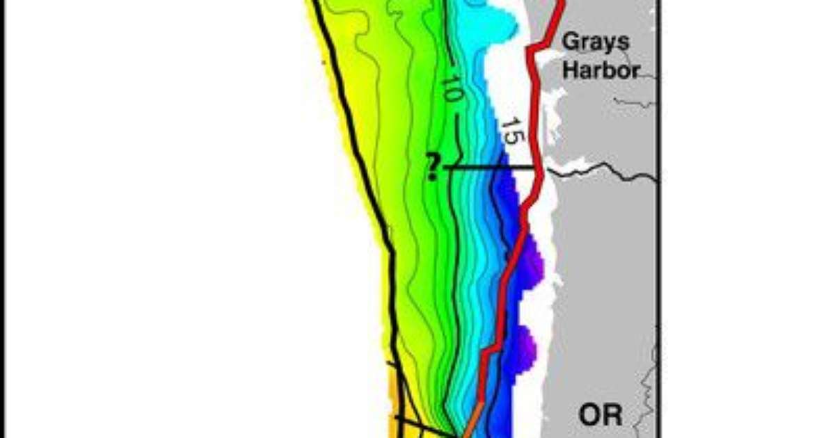
Next, check out the new map of the Cascadia subregion. In the figure, the diagonal black islands represent each of the four major divisions. Also, different colors indicate the depth of the fault, with yellow indicating shallow points and purple indicating deep ones:
Security arrangements
The team’s next step is to convert the captured information into actionable data, thereby helping public authorities define Building standards against high-magnitude earthquakes, for example. Other steps can be taken to avoid future tragedies in the United States and Canada.
Source: Scientific advances This is Columbia School of Climate
Popularity at Canaltech:

“Internet evangelist. Writer. Hardcore alcoholaholic. Tv lover. Extreme reader. Coffee junkie. Falls down a lot.”


More Stories
Kamala has warned that democracy in America will be in danger if Trump wins
The world’s rarest donkey has been born at a zoo in the United Kingdom; Watch the video
Senators travel to America in search of best practices…