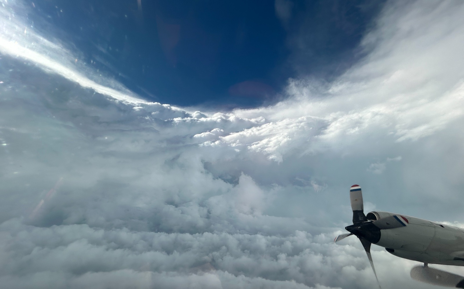
Eye of Hurricane Beryl as it reaches maximum intensity over the Caribbean with winds near 300 km/h | NOAA
In the eye of devastating Hurricane Beryl. U.S. Air Force reconnaissance flights collecting meteorological data have reached the heart of Hurricane Beryl, which is barreling through the Caribbean, leaving behind destruction and at least seven dead.
The crew flew into Beryl’s eye yesterday as the storm reached Category 5, the maximum on the Saffir-Simpson hurricane scale, with sustained surface winds of 260 km/h and gusts approaching 300 km/h.
The storm is historic because it set several records. Beryl formed on Friday in the southeastern Antilles and quickly became a Category 1 hurricane on Saturday. It formed “much further east in the Atlantic than is typical for this time of year,” said Andra Garner, a climate scientist at Rowan University.
The phenomenon is linked, she says, to the current temperature of the Atlantic Ocean, which is not usually warm enough in these areas at this time of year to allow a storm of this type to form. “A hurricane has never formed this far east, this early in the year,” Brian McNoldy, a hurricane researcher at the University of Miami, adds in his blog.
Hurricane Beryl rapidly intensified into a major Category 4 hurricane in less than a day: “It’s hard to put into words how amazing this is,” says Brian McNoldy.
But while it’s “amazing to see this phenomenon right in front of our eyes,” it’s also “consistent with what science tells us we can expect from a warmer world,” says Andra Garner, who published a study on the phenomenon of tropical cyclone intensification.
Beryl strengthened to Category 4 on Sunday, the last day of June. Never before had a hurricane of that magnitude been recorded in June. On Monday, it reached Category 5, the highest on the Saffir-Simpson Hurricane Scale, a new record, becoming the first Category 5 hurricane in Atlantic history, two weeks before Hurricane Emily in 2005, and the first before that.
While flying into Beryl when it was a Category 5, the crew on board the hurricane plane captured stunning images of the eyewall structure at the center of the devastating storm.
A look into the eye of 👁️ Hurricane Beryl today. Late Monday, Beryl became the first storm to develop into a Category 5 hurricane in the Atlantic, though it was downgraded to a Category 4 on Tuesday.
For the latest forecasts visit https://t.co/96ZlCzpVcZ#HurricaneBeryl pic.twitter.com/Dd81YzOuuM
– Hurricane Hunters (@53rdWRS) July 2, 2024
The images clearly show the so-called stadium effect. This is because the appearance is of a stadium with a circular cloud wall equivalent to the stands and the open space from the eye of the tropical cyclone to the open area above the stadium.
Beryl passed south of Jamaica today as a Category 4 hurricane, and once again, there was a reconnaissance flight in the center of the storm to collect more wind and barometric pressure data to help with forecasting.
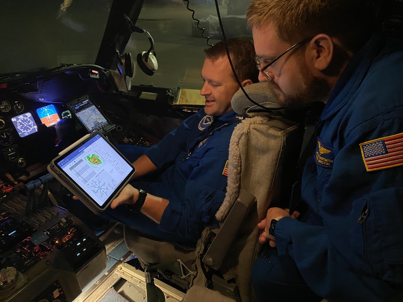
On Wednesday’s flight, according to meteorologist Jeremy DeHart, part of the hurricane-hunting team who was on the plane, conditions were more complicated with increased turbulence and cold. According to him, the eye was no longer open and was covered by clouds, with the northeastern section of the eye wall experiencing the most turbulence.
#beryl Still packs a punch. We were stuck in a soup all day. Every radar signal in the northern hemisphere was rough. I went from open eyewall to completely closed eyewall as I approached Jamaica with a really bad eyewall. I got a shoutout on the last two passes. This thing is a fighter. @53rdWRS pic.twitter.com/8cUCBRGEVL
—Jeremy DeHart (@JeremyDeHart53d) July 3, 2024
According to the planned route, Beryl will advance into the Mexican state of Quintana Roo, home to the resorts of Cancun and the Riviera Maya, where it is expected to arrive between dawn and Friday morning.
Hurricane Hunters
Why do pilots take such a risk when flying into a hurricane? Scientists on board launch radiosondes into the eye of the storm from the aircraft, collecting data such as air pressure and winds. This data is essential to determining the intensity of a hurricane, and once fed into computers, it allows weather models to more accurately predict its intensity and path.
How do planes not crash? Generally, planes are not destroyed by high winds during flight. Airplanes generally tend to fly in jet streams with winds exceeding 250 km/h in different parts of the world.
It is shear, or a sudden change in horizontal or vertical winds, that can destroy an aircraft or cause it to lose control. This is why airplanes Hurricane Hunter From NOAA Do not face hurricanes.

Noa
NOAA pilots and crew are accustomed to flying in a hurricane’s windy environment and are not afraid of destroying the aircraft, but they are always watching for severe weather and shear points that they can often spot on radar and are therefore able to avoid if they are too severe.
The Hurricane Hunters belong to the 53rd Weather Reconnaissance Squadron, based out of Keesler Air Force Base in Biloxi, Mississippi. Its members trace their hurricane-hunting roots back to 1943, when two Army Air Corps pilots flew into a tornado near Texas.

Noa
Despite the severity of storms like Ida and the enormous danger to the ground, air travel has an incredible safety record. No plane has been lost in more than four decades. The last time was in 1974.
About six hurricane or tornado-hunting aircraft have been lost in total throughout history, killing 53 people. Today, the missions are largely performed by U.S. Air Force reservists who return to their jobs in the civilian world after a few days or weeks of storm chasing.
Eye of the hurricane
Characteristic of very intense hurricanes, Ida’s eye was very well defined in satellite imagery Sunday morning. The eye was already a few miles from touching land on the Louisiana coast.
The most distinctive feature of a hurricane is the eye. It is located at the center and is between 20 and 50 kilometers in diameter. The eye is the center of the hurricane, the point around which the rest of the storm rotates and where the lowest surface pressures in the storm are located.
Check out this itinerary @NOAA_AOML & @NOAA_HurrHunter Took through the eye of a Cat5 hurricane #beryl yesterday!
While they were collecting data from the air, they @saildrone The sea glider collected data from the ocean.Learn more about #tornado research: https://t.co/g3B46nRZuY @ Noa pic.twitter.com/toicQEl4DX
– NOAA Research July 3, 2024
The sky is usually clear or with few clouds above the eye and the winds are relatively light. In fact, this is the quietest part of any hurricane. Why? The eye is so quiet because the strong surface winds now converge toward the center and never reach it. The Coriolis force deflects the wind slightly away from the center, causing the winds to swirl around the center of the hurricane (the eye wall), leaving the exact center (the eye) calm.
An eye becomes visible when some of the rising air in the eye wall is forced toward the center of the storm, rather than outward, where most of it goes. This mass of air is pushing toward the center from all directions. This convergence causes air to actually enter the eye. This sinking creates a warmer environment and the clouds evaporate, leaving a clear area.
MetSul Meteorologia is on WhatsApp channels. Subscribe here To access the channel in the messaging application and receive forecasts, alerts and information on the most important weather and climate events in Brazil and around the world, with exclusive data and information from our team of meteorologists.

“Music fanatic. Professional problem solver. Reader. Award-winning tv ninja.”


![[VÍDEO] Elton John’s final show in the UK has the crowd moving](https://www.tupi.fm/wp-content/uploads/2023/06/Elton-John-1-690x600.jpg)


More Stories
A South African YouTuber is bitten by a green mamba and dies after spending a month in a coma
A reptile expert dies after a snake bite
Maduro recalls his ambassador to Brazil in a move to disavow him and expand the crisis