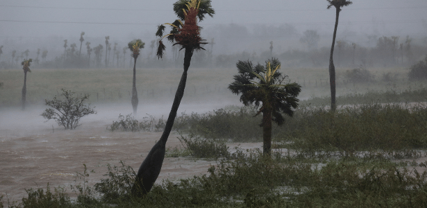
With winds exceeding 200 km/h, Hurricane Ian recently hit Cuba and is heading toward Florida, where it is expected to arrive on Wednesday (28). It has increased in intensity and is now a Category 3 hurricane rating – which is up to 5.
But what do these numbers mean? What is the difference between storms?
The scale used to determine the intensity of a hurricane is called the Saffir-Simpson Scale, which was created in the United States in 1970. Divided into five categories, it takes into account wind speed and the damage this storm can cause—similar to the Richter scale it does with earthquakes.
The US National Hurricane Center (NHC) explains the division as follows:
- Tropical Storm: Winds from 63 km/h to 118 km/h. It is the initial stage in which the weather phenomenon begins to be observed.
- Category 1: Winds from 119 km/h to 153 km/h. It can cause some damage to roofs, trees and power lines. Possible flooding in coastal areas.
- Category 2: Winds from 154 km/h to 177 km/h. They are considered extremely dangerous and even solid buildings must suffer damage; Complete loss of energy and falling trees is to be expected.
- Class 3: Winds from 178 km/h to 208 km/h. Devastating damage is expected, with electricity and water supplies potentially interrupted for days, streets and roads blocked by fallen trees, and buildings such as homes and awnings expected to suffer severe damage with complete loss of roofs, windows and doors.
- Category 4: Winds from 209 km/h to 251 km/h. Catastrophic damage is expected, including requests to evacuate area residents, power outages that can last for months, flooding that can isolate residential areas, and significant structural damage.
- Category 5: Winds of 252 km/h or more. Catastrophic and possibly incalculable damage. All security measures and issues mentioned in the previous categories are designated as Category 5.
Hurricane Katrina, which caused $117 billion in damage and killed more than 1,800 people in 2005, was a Category 5 hurricane. The other most destructive hurricane in US history was Hurricane Harvey, Category 4, in 2017. Losses amounted to $62 billion . In the same year, the area was affected by two other Level 5 events: Irma and Maria.
How do hurricanes form?
Regardless of the category, NASA explains that tropical cyclones that form in the Atlantic or eastern Pacific are all called hurricanes, and they all form in the same way.
They all use warm, moist air as “fuel”, which is why they only form in warm ocean waters near the equator. As warm air rises, it creates a region of lower pressure near the surface. Air coming from nearby surfaces of high pressure begins to compress the area of low pressure, creating “pure” air and making it hot, causing it to rise as well.
As the warm air cools, clouds form and the entire cloud and wind system begins to circulate, affected by heat and evaporating water from the ocean.
Storms that form north of the equator rotate counterclockwise, while storms south of the equator rotate clockwise. As the storm rotates faster and faster, an eye forms in the center with very low pressure.
NASA mission postponed due to hurricane
Experts expect Hurricane Ian to make landfall north of the Tampa Bay or Panhandle (both in Florida) early Friday. In anticipation of the storm’s arrival in the region, NASA decided to remove the Artemis 1 mission rocket from the launch pad at the Kennedy Space Center, also located in Florida. The launch was scheduled for Tuesday (27).
The SLS (Space Launch System) and the Orion capsule will be stored in a warehouse until November, when the launch should take place. That’s because the next date that NASA considered, October 2, has already been ruled out.
The bootload now accumulates three times the delay. Previously, the agency had already attempted to launch the SLS on August 29 and September 3, but encountered technical problems.


![[VÍDEO] Elton John’s final show in the UK has the crowd moving](https://www.lodivalleynews.com/wp-content/uploads/2023/06/Elton-John-1-690x600.jpg)


More Stories
The Director of Ibict receives the Coordinator of CESU-PI – Brazilian Institute for Information in Science and Technology
A doctor who spreads fake news about breast cancer is registered with the CRM of Minas
The program offers scholarships to women in the field of science and technology